Portal:Countries
The Countries Portal A country is an area of land with defined borders, culture, and government. Usually, the term country is applied to occupied areas of land, however it can be used to refer to uninhabited areas or wastelands. When referring to a specific polity, the term "country" may refer to a sovereign state, a state with limited recognition, a constituent country, or a dependent territory. Most sovereign states, but not all countries, are members of the United Nations. There is no universal agreement on the number of "countries" in the world with a range between 193 to 237. This ambiguity is a result of several states having disputed sovereignty status or limited recognition, and a number of non-sovereign entities are commonly considered countries. The definition and usage of the word "country" has fluctuated and changed over time. The Economist wrote in 2010 that "any attempt to find a clear definition of a country soon runs into a thicket of exceptions and anomalies." Areas much smaller than a political entity may be referred to as a "country", such as the West Country in England, "big sky country" (used in various contexts of the American West), "coal country" (used to describe coal-mining regions), or simply "the country" (used to describe a rural area). The term "country" is also used as a qualifier descriptively, such as country music or country living. (Full article...)
|

| Part of a series on |
| Nationalism |
|---|
General images -
-
 Solar cookers use sunlight as energy source for outdoor cooking. (from Developing country)
 -
 Percentage of women older than 14 who have experienced violence by an intimate partner (from Developing country)
 -
 Percentage of people with undernutrition by country, World Food Program, 2020Under 2.5%2.5% – 5.0%5.0% – 14.9%15.0% – 24.9%25.0% – 34.9%Over 35.0%No data(from Developing country)
 -
_per_capita_in_2024.svg.png) GDP (PPP) per capita in 2024(from Developing country)
GDP (PPP) per capita in 2024(from Developing country)- >$60,000
- $50,000 – $60,000
- $40,000 – $50,000
- $30,000 – $40,000
- $20,000 – $30,000
- $10,000 – $20,000
- $5,000 – $10,000
- $2,500 – $5,000
- $1,000 – $2,500
- <$1,000
- No data
-
 Map of the Darién Gap at the border between Colombia and Panama (from List of transcontinental countries)
 -
 Surface air temperature change over the past 50 years. (from Developing country)
 -
 Map of countries by total fertility rate (2022–2023), referring to the average number of children that are born to a woman over her lifetime, according to the Population Reference Bureau. (from Developing country)
 -
.svg.png) Comparison map: Greenland, the Faroe Islands (enlarged) and Denmark differ significantly in size. The Danish Realm is spread across the North Atlantic Ocean and North Sea. (from List of transcontinental countries)
Comparison map: Greenland, the Faroe Islands (enlarged) and Denmark differ significantly in size. The Danish Realm is spread across the North Atlantic Ocean and North Sea. (from List of transcontinental countries) -
 Conventions used for the boundary between Asia and Europe during the 18th and 19th centuries. The red line shows the most common modern convention, in use since c. 1850.AsiaEuropehistorically placed in either continent(from List of transcontinental countries)
 -

-
 Flags of the United Nations member and non-member GA observer states in front of the Palace of Nations in Geneva, Switzerland (from List of sovereign states)
 -
 African land part of EgyptAsian land part of EgyptThe rest of AfricaThe rest of Asia(from List of transcontinental countries)
 -
 A formation of human chain at India Gate by the women from different walks of life at the launch of a National Campaign on prevention of violence against women, in New Delhi on 2 October 2009 (from Developing country)
 -

-
 Global rates of population growth and decline (2021); population growth rate takes birth, death, and migration rates into account. Future projections are based on the United Nations World Population Prospects (from 1950 until 2100). (from Developing country)
 -

-

-
 A map of World Bank high-income economies in 2023
 -
 Emerging/developing markets by the IMFData unavailable
The latest classifications sorted by the IMF and the UN (from Developing country) -
.svg.png) World map representing Human Development Index categories (based on 2023 data, published in 2025)(from Developing country)
World map representing Human Development Index categories (based on 2023 data, published in 2025)(from Developing country)- Very high
- High
- Medium
- Low
- No data
-

-
 Least developed economies according to ECOSOCLeast developed economies out of scope of the ECOSOCGraduated to developing economy
(from Developing country)
Countries of the world -

Cambodia, officially the Kingdom of Cambodia, is a country in Mainland Southeast Asia. It is bordered by Thailand to the northwest, Laos to the north, and Vietnam to the east, and has a coastline along the Gulf of Thailand in the southwest. It spans an area of 181,035 square kilometres (69,898 square miles), dominated by a low-lying plain and the confluence of the Mekong river and Tonlé Sap, Southeast Asia's largest lake. It is dominated by a tropical climate. Cambodia has a population of about 17 million people, the majority of which are ethnically Khmer. Its capital and most populous city is Phnom Penh, followed by Siem Reap and Battambang.
In 802 AD, Jayavarman II declared himself king, uniting the warring Khmer princes of Chenla under the name "Kambuja". This marked the beginning of the Khmer Empire. The Indianised kingdom facilitated the spread of first Hinduism and then Buddhism to Southeast Asia and undertook religious infrastructural projects throughout the region, the most famous of which is Angkor Wat. In the 15th century, it began a decline in power until, in 1863, Cambodia became a French protectorate. Following Japanese occupation during World War II, Cambodia declared independence from France in 1953. The Vietnam War embroiled the country in civil war during the 1960s, culminating in a 1970 coup which installed the US-aligned Khmer Republic and the takeover of the communist Khmer Rouge in 1975. The Khmer Rouge ruled the country and carried out the Cambodian genocide from 1975 until 1979, until they were ousted during the Cambodian–Vietnamese War. Peace was restored by the 1991 Paris Peace Accords and subsequent United Nations peacekeeping mission, establishing a new constitution, holding the 1993 general election, and ending long-term insurgencies. The 1997 coup d'état consolidated power under Prime Minister Hun Sen and the Cambodian People's Party (CPP). (Full article...)
Top 10 WikiProject Countries Popular articles of the month
-
 Greenland is an autonomous territory of the Kingdom of Denmark and is the largest of the kingdom's three constituent parts by land area, the others being Denmark proper and the Faroe Islands. Citizens of Greenland are citizens of Denmark. They are thus citizens of the European Union (EU), although Greenland is not part of the EU. It is the world's largest island and lies between the Arctic and Atlantic oceans, east of the Canadian Arctic Archipelago. It shares a small 1.2-kilometre (0.75 mi) border with Canada on Hans Island. The capital and largest city is Nuuk. Kaffeklubben Island off the northern coast is the world's northernmost undisputed point of land – Cape Morris Jesup on the main island was thought to be so until the 1960s. Economically, Greenland is heavily reliant on aid from Denmark, which has averaged 5.4 billion kr. (€724 million) annually in the period 2019–2023, amounting to more than 20% of the territory's gross domestic product.
Though a part of the continent of North America, Greenland was politically and culturally associated with the European kingdom of Norway from 986 until the early 15th century. From the 18th century, following the union of Denmark and Norway and the establishment of the Nuuk settlement, Greenland gradually became associated with Denmark. Greenland has been inhabited at intervals over at least the last 4,500 years by circumpolar peoples whose forebears migrated there from what is now Canada. Norsemen from Norway settled the uninhabited southern part of Greenland beginning in the 10th century (having previously settled Iceland), and their descendants lived in Greenland for 400 years until disappearing in the late 15th century. From the late 15th century, the Portuguese attempted to find the northern route to Asia, which ultimately led to the earliest cartographic depiction of the coastline. In the 17th century, Dano-Norwegian explorers reached Greenland again, finding their earlier settlement extinct and reestablishing a permanent Scandinavian presence.
When Denmark and Norway separated in 1814, Greenland was transferred from the Norwegian to the Danish crown. The 1953 Constitution of Denmark ended Greenland's status as a colony, integrating it fully into the Danish state. In the 1979 Greenlandic home rule referendum, Denmark granted home rule to Greenland. In the 2008 Greenlandic self-government referendum, Greenlanders voted for the Self-Government Act which transferred more power from the Danish government to the local Naalakkersuisut (Greenlandic government). Under this structure, Greenland gradually assumed responsibility for governmental services and areas of competence. The Danish government retains control of citizenship, monetary policy, security policies, and foreign affairs. With the melting of the ice due to global warming, its abundance of mineral wealth, and its strategic position between Eurasia, North America, and the Arctic zone, Greenland holds strategic importance for the Kingdom of Denmark, NATO, and the European Union. Since 2025, the United States has pursued threats to annex Greenland, triggering the Greenland crisis. (Full article...) -
Venezuela, officially the Bolivarian Republic of Venezuela, is a country on the northern coast of South America, consisting of a continental landmass and various islands and islets in the Caribbean Sea. It comprises an area of 912,050 km2 (352,140 sq mi), with a population estimated at 31.8 million in 2025. The capital and largest urban agglomeration is Caracas. The continental territory is bordered on the north by the Caribbean Sea and the Atlantic Ocean, on the west by Colombia, Brazil on the south, Trinidad and Tobago to the north-east, and on the east by Guyana. Venezuela consists of 23 states, the Capital District, and federal dependencies covering Venezuela's offshore islands. Venezuela is among the most urbanized countries in Latin America; the vast majority of Venezuelans live in the cities of the north and in the capital.
The territory of Venezuela was colonized by Spain in 1522, amid resistance from indigenous peoples. In 1811, it became one of the first Spanish-American territories to declare independence from the Spanish and to form part of the first federal Republic of Colombia (Gran Colombia). It separated as a fully sovereign country in 1830. During the 19th century, Venezuela suffered political turmoil and autocracy, remaining dominated by regional military dictators until the mid-20th century. From 1958, the country had a series of democratic governments, as an exception where most of the region was ruled by military dictatorships, and the period was characterized by economic prosperity. Economic shocks in the 1980s and 1990s led to major political crises and widespread social unrest, including the deadly Caracazo riots of 1989, two attempted coups in 1992, and the impeachment of a president for embezzlement of public funds charges in 1993. Confidence in the existing political parties collapsed during the 1998 Venezuelan presidential election, in which Hugo Chávez was elected and which became the catalyst for the Bolivarian Revolution. During the 1999 Constituent Assembly, a new Constitution of Venezuela was written and ratified.
The government's populist social welfare policies were temporarily bolstered by soaring oil prices, temporarily increasing social spending and reducing economic inequality and poverty in the early years of the Chávez regime. Poverty began to rapidly increase, however, in mid- to late 2014. The 2013, 2018 and 2024 presidential elections were all widely disputed, with opposition candidates being arrested or exiled. This led to widespread protest and international condemnation, which triggered another nationwide crisis. In January 2026, the United States captured President Nicolás Maduro. Vice President Delcy Rodríguez was sworn in as acting president. (Full article...) -
The United States of America (USA), also known as the United States (U.S.) or America, is a country primarily located in North America. It is a federal republic of 50 states and a federal capital district, Washington, D.C. The 48 contiguous states border Canada to the north and Mexico to the south, with the semi-exclave of Alaska in the northwest and the archipelago of Hawaii in the Pacific Ocean. The United States also asserts sovereignty over five major island territories and various uninhabited islands in Oceania and the Caribbean. It is a megadiverse country, with the world's third-largest land area and third-largest population, exceeding 341 million.
Paleo-Indians first migrated from North Asia to North America at least 15,000 years ago, and formed various civilizations. Spanish colonization established Spanish Florida in 1513, the first European colony in what is now the continental United States. British colonization followed with the 1607 settlement of Virginia, the first of the Thirteen Colonies. Enslavement of Africans was practiced in all colonies by 1770 and supplied most of the labor for the Southern Colonies' plantation economy. Clashes with the British Crown began as a civil protest over the illegality of taxation without representation in Parliament and the denial of other English rights. They evolved into the American Revolution, which led to the Declaration of Independence and a society based on universal rights. Victory in the 1775–1783 Revolutionary War brought international recognition of U.S. sovereignty and fueled westward expansion, further dispossessing native inhabitants. As more states were admitted, a North–South division over slavery led the Confederate States of America to declare secession and fight the Union in the 1861–1865 American Civil War. With the United States' victory and reunification, slavery was abolished nationally. By the late 19th century, the U.S. economy outpaced the French, German and British economies combined. As of 1900, the country had established itself as a great power, a status solidified after its involvement in World War I. Following Japan's attack on Pearl Harbor in 1941, the U.S. entered World War II. Its aftermath left the U.S. and the Soviet Union as rival superpowers, competing for ideological dominance and international influence during the Cold War. The Soviet Union's collapse in 1991 ended the Cold War, leaving the U.S. as the world's sole superpower.
The U.S. federal government is a representative democracy with a president and a constitution that grants separation of powers under three branches: legislative, executive, and judicial. The United States Congress is a bicameral national legislature composed of the House of Representatives (a lower house based on population) and the Senate (an upper house based on equal representation for each state). Federalism grants substantial autonomy to the 50 states. In addition, 574 Native American tribes have sovereignty rights, and there are 326 Native American reservations. Since the 1850s, the Democratic and Republican parties have dominated American politics. American ideals and values are based on a democratic tradition inspired by the American Enlightenment movement. (Full article...) -
Iran, officially the Islamic Republic of Iran, and also known as Persia, is a country in West Asia. It borders Iraq to the west, Turkey, Azerbaijan, and Armenia to the northwest, the Caspian Sea to the north, Turkmenistan to the northeast, Afghanistan to the east, Pakistan to the southeast, and the Gulf of Oman and the Persian Gulf to the south. With a population of over 90 million, Iran ranks 17th globally in both geographic size and population and is the sixth-largest country in Asia. It is divided into five regions with 31 provinces. Tehran is the nation's capital, largest city, and financial center.
Home to one of the world's oldest continuous major civilizations, most of Iran was first united as a nation by the Medes under Cyaxares in the 7th century BC and reached its territorial height in the 6th century BC, when Cyrus the Great founded the Achaemenid Empire. Alexander the Great conquered the empire in the 4th century BC. An Iranian rebellion in the 3rd century BC established the Parthian Empire, which later liberated the country. In the 3rd century AD, the Parthians were succeeded by the Sasanian Empire, which oversaw a golden age in the history of Iranian civilization. During this period, ancient Iran saw some of the earliest developments of writing, agriculture, urbanization, religion, and administration. Once a center for Zoroastrianism, Iran underwent Islamization following the 7th century AD Muslim conquest. Innovations in literature, philosophy, mathematics, medicine, astronomy and art were renewed during the Islamic Golden Age and Iranian Intermezzo, a period during which Iranian Muslim dynasties ended Arab rule and revived the Persian language. This era was followed by Seljuk and Khwarazmian rule, Mongol conquests and the Timurid Renaissance from the 11th to 14th centuries.
In the 16th century, the native Safavid dynasty re-established a unified Iranian state with Twelver Shia Islam as the official religion, laying the framework for the modern state of Iran. During the Afsharid Empire in the 18th century, Iran was a leading world power, but it lost this status after the Qajars took power in the 1790s. The early 20th century saw the Persian Constitutional Revolution and the establishment of the Pahlavi dynasty by Reza Shah, who ousted the last Qajar Shah in 1925. Following the Anglo-Soviet invasion of Iran in 1941, his son Mohammad Reza Pahlavi rose to power. Attempts by Mohammad Mosaddegh to nationalize the oil industry led to the Anglo-American coup in 1953. The Iranian Revolution in 1979 overthrew the monarchy, and the Islamic Republic of Iran was established by Ruhollah Khomeini, the country's first supreme leader. In 1980, Iraq invaded Iran, sparking the eight-year-long Iran–Iraq War, which ended in a stalemate. Iran has since been involved in proxy wars with Israel and Saudi Arabia; in 2025, Israeli strikes on Iran escalated tensions into the Iran–Israel war. Following the war and amid a growing economic crisis, potentially the largest protests since 1979 erupted in late December 2025. (Full article...) -
Gross domestic product (GDP) is the market value of all final goods and services from a nation in a given year. Countries are sorted by nominal GDP estimates from financial and statistical institutions, which are calculated at market or government official exchange rates. Nominal GDP does not take into account differences in the cost of living in different countries, and the results can vary greatly from one year to another based on fluctuations in the exchange rates of the country's currency. Such fluctuations may change a country's ranking from one year to the next, even though they often make little or no difference in the standard of living of its population.
Comparisons of national wealth are also frequently made based on purchasing power parity (PPP), to adjust for differences in the cost of living in different countries. Other metrics, nominal GDP per capita and a corresponding GDP (PPP) per capita, are used for comparing national standard of living. On the whole, PPP per capita figures are less spread than nominal GDP per capita figures.
The rankings of national economies have changed significantly over time. For instance, the United States overtook the British Empire around 1916; Japan rose rapidly in the post-World War II period to become the world’s second-largest economy by the 1970s; China moved from ninth place in 1978 to second in 2010 following market reforms. These shifts reflect long-term changes in global economic output. (Full article...) -
The United Kingdom of Great Britain and Northern Ireland, commonly known as the United Kingdom (UK) or Britain, is a country in northwestern Europe, off the coast of the continental mainland. It comprises England, Scotland, Wales and Northern Ireland, with a population of over 69 million in 2024. The UK includes the island of Great Britain, the north-eastern part of the island of Ireland, and most of the smaller islands within the British Isles, covering 94,354 square miles (244,376 km2). It shares a land border with the Republic of Ireland and is surrounded by the Atlantic Ocean, the North Sea, the English Channel, the Celtic Sea and the Irish Sea, while maintaining sovereignty over the Crown Dependencies and the British Overseas Territories. The capital and largest city of England and the UK is London; Edinburgh, Cardiff and Belfast are the national capitals of Scotland, Wales and Northern Ireland.
Britain has been continuously inhabited since the Neolithic. In AD 43 the Roman conquest of Britain began. The Roman departure between 383 and 410 was followed by Anglo-Saxon settlement beginning around 450. In 1066 the Normans conquered England. Over the 17th century the role of the British monarchy was reduced, particularly as a result of the English Civil War. In 1707 the Kingdom of England and the Kingdom of Scotland united under the Treaty of Union to create the Kingdom of Great Britain. The Acts of Union 1800 incorporated the Kingdom of Ireland to create the United Kingdom of Great Britain and Ireland in 1801. Most of Ireland seceded from the UK in 1922 as the Irish Free State, and the Royal and Parliamentary Titles Act 1927 created the present United Kingdom.
The UK became the first industrialised country and was the world's foremost power for the majority of the 19th and early 20th centuries, particularly during the Pax Britannica between 1815 and 1914. The British Empire was the leading economic power for most of the 19th century, a position supported by its agricultural prosperity, its role as a dominant trading nation, a massive industrial capacity, significant technological achievements, and the rise of 19th-century London as the world's principal financial centre. At its height in the 1920s, the empire encompassed around a quarter of the world's landmass and population, and was the largest in history. However, its involvement in the First World War and in the Second World War damaged Britain's economic power, and a global wave of decolonisation led to the independence of most British colonies. (Full article...) -
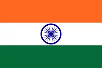
India, officially the Republic of India, is a country in South Asia. It is the seventh-largest country by area; the most populous country since 2023; and, since its independence in 1947, the world's most populous democracy. Bounded by the Indian Ocean on the south, the Arabian Sea on the southwest, and the Bay of Bengal on the southeast, it shares land borders with Pakistan to the west; China, Nepal, and Bhutan to the north; and Bangladesh and Myanmar to the east. In the Indian Ocean, India is near Sri Lanka and the Maldives; its Andaman and Nicobar Islands share a maritime border with Myanmar, Thailand, and Indonesia.
Modern humans arrived on the Indian subcontinent from Africa no later than 55,000 years ago. Their long occupation, predominantly in isolation as hunter-gatherers, has made the region highly diverse. Settled life emerged on the subcontinent in the western margins of the Indus river basin 9,000 years ago, evolving gradually into the Indus Valley Civilisation of the third millennium BCE. By 1200 BCE, an archaic form of Sanskrit, an Indo-European language, had diffused into India from the northwest. Its hymns recorded the early dawnings of Hinduism in India. India's pre-existing Dravidian languages were supplanted in the northern regions. By 400 BCE, caste had emerged within Hinduism, and Buddhism and Jainism had arisen, proclaiming social orders unlinked to heredity. Early political consolidations gave rise to the loose-knit Maurya and Gupta Empires. This era was noted for creativity in art, architecture, and writing, but the status of women declined, and untouchability became an organised belief. In South India, the Middle kingdoms exported Dravidian language scripts and religious cultures to the kingdoms of Southeast Asia.
In the 1st millennium, Islam, Christianity, Judaism, and Zoroastrianism became established on India's southern and western coasts. In the early centuries of the 2nd millennium Muslim armies from Central Asia intermittently overran India's northern plains. The resulting Delhi Sultanate drew northern India into the cosmopolitan networks of medieval Islam. In south India, the Vijayanagara Empire created a long-lasting composite Hindu culture. In the Punjab, Sikhism emerged, rejecting institutionalised religion. The Mughal Empire ushered in two centuries of economic expansion and relative peace, and left a rich architectural legacy. Gradually expanding rule of the British East India Company turned India into a colonial economy but consolidated its sovereignty. British Crown rule began in 1858. The rights promised to Indians were granted slowly, but technological changes were introduced, and modern ideas of education and the public life took root. A nationalist movement emerged in India, the first in the non-European British Empire and an influence on other nationalist movements. Noted for nonviolent resistance after 1920, it became the primary factor in ending British rule. In 1947, the British Indian Empire was partitioned into two independent dominions, a Hindu-majority dominion of India and a Muslim-majority dominion of Pakistan. A large-scale loss of life and an unprecedented migration accompanied the partition. (Full article...) -
China, officially the People's Republic of China (PRC), is a country in East Asia. It is the second-most populous country after India, with a population exceeding 1.4 billion, representing 17% of the world's population. China borders fourteen countries by land across an area of 9.6 million square kilometers (3,700,000 sq mi), making it the third-largest country by area. The country is divided into 33 province-level divisions: 22 provinces, 5 autonomous regions, 4 municipalities, and 2 semi-autonomous special administrative regions. Beijing is the capital, while Shanghai is the most populous city by urban area and largest financial center.
The first humans in China arrived during the Paleolithic era. By the 2nd millennium BCE dynastic states had emerged in the Yellow River basin. The 8th–3rd centuries BCE saw a breakdown in the authority of the Zhou dynasty, accompanied by the emergence of administrative and military techniques, literature and philosophy. In 221 BCE, China was unified under an emperor, ushering in two millennia of imperial rule. Chinese achievements include the invention of gunpowder, paper, printing and the compass, the establishment of the Silk Road, and the building of the Great Wall. Chinese culture has flourished and has had a great influence on the region and beyond. China began to cede parts of the country in the 19th century, to European powers through a series of unequal treaties. The 1911 Revolution overthrew the Qing dynasty and the Republic of China was established the following year. The country was unstable and fragmented during the Warlord Era, this came to an end with the Northern Expedition conducted by the Kuomintang to reunify the country.
The Chinese Civil War began in 1927, when Kuomintang forces purged members of the Chinese Communist Party (CCP). China was invaded by the Empire of Japan in 1937, leading the CCP and Kuomintang to form the Second United Front to fight the Japanese. The Second Sino-Japanese War ended in a Chinese victory; however, the CCP and the Kuomintang resumed their civil war. In 1949, the CCP proclaimed the People's Republic of China and forced the Kuomintang-led government to retreat to the island of Taiwan. The country was split, with both sides claiming to be the legitimate government. Following the implementation of land reforms, attempts by the CCP to realize communism failed: the Great Leap Forward was responsible for the Great Chinese Famine which resulted in millions of deaths, and the Cultural Revolution was a period of turmoil and persecution. The reform and opening up that began in 1978 moved the country away from a planned economy towards a market-based economy, spurring an economic boom. A movement for political liberalization stalled after the 1989 Tiananmen Square protests and massacre. (Full article...) -
Canada is a country in North America. Its ten provinces and three territories extend from the Atlantic Ocean to the Pacific Ocean and northward into the Arctic Ocean, making it the second-largest country by total area, with the longest coastline of any country. Its border with the United States is the longest international land border. The country is characterized by a wide range of both meteorologic and geological regions. With a population of over 41 million, it has widely varying population densities, with the majority residing in its urban areas and large areas being sparsely populated. Its capital is Ottawa and its three largest metropolitan areas are Toronto, Montreal, and Vancouver.
Indigenous peoples have continuously inhabited what is now Canada for thousands of years. Beginning in the 16th century, British and French expeditions explored and later settled along the Atlantic coast. As a consequence of various armed conflicts, France ceded nearly all of its colonies in North America in 1763. In 1867, with the union of three British North American colonies through Confederation, Canada was formed as a federal dominion of four provinces. This began an accretion of provinces and territories resulting in the displacement of Indigenous populations, and a process of increasing autonomy from the United Kingdom. This increased sovereignty was highlighted by the Statute of Westminster, 1931, and culminated in the Canada Act 1982, which severed the vestiges of legal dependence on the Parliament of the United Kingdom.
Canada is a parliamentary democracy and a constitutional monarchy in the Westminster tradition. The country's head of government is the prime minister, who holds office by virtue of their ability to command the confidence of the elected House of Commons and is appointed by the governor general, representing the monarch of Canada, the ceremonial head of state. The country is a Commonwealth realm and is officially bilingual (English and French) in the federal jurisdiction. It is very highly ranked in international measurements of government transparency, quality of life, economic competitiveness, innovation, education and human rights. It is one of the world's most ethnically diverse and multicultural nations, the product of large-scale immigration. Canada's long and complex relationship with the United States has had a significant impact on its history, economy, and culture. (Full article...) -
Denmark is a Nordic country in Northern Europe. It is the metropole and most populous constituent of the Kingdom of Denmark, also known as the Danish Realm, a constitutionally unitary state that includes the autonomous territories of the Faroe Islands and Greenland in the north Atlantic Ocean. Metropolitan Denmark, also called "continental Denmark" or "Denmark proper", consists of the northern Jutland peninsula and an archipelago of 406 islands. It is the southernmost of the Scandinavian countries, lying southwest of Sweden, south of Norway, and north of Germany, with which it shares a short border. Denmark proper is situated between the North Sea to the west and the Baltic Sea to the east.
The Kingdom of Denmark, including the Faroe Islands and Greenland, has roughly 1,400 islands greater than 100 square metres (1,100 sq ft) in area; 443 have been named and 78 are inhabited. Denmark's population is over 6 million (1 May 2025), of which roughly 40% live in Zealand, (Sjælland) the largest and most populated island in Denmark proper; Copenhagen, (København) the capital and largest city of the Danish Realm, is situated on Zealand and Amager and Slotsholmen. Composed mostly of flat, arable land, Denmark is characterised by sandy coasts, low elevation, and a temperate climate. Denmark exercises hegemonic influence in the Danish Realm, devolving powers to the other constituent entities to handle their internal affairs. Home rule was established in the Faroe Islands in 1948; Greenland achieved home rule in 1979 and further autonomy in 2009.
The unified Kingdom of Denmark emerged in the eighth century AD as a maritime power amid the struggle for control of the Baltic Sea. In 1397, it formed the Kalmar Union with Norway and Sweden. This union persisted until Sweden's secession in 1523. The remaining Kingdom of Denmark–Norway endured a series of wars in the 17th century that resulted in territorial cessions to Sweden. A surge of nationalist movements in the 19th century were defeated by the Danes in the First Schleswig War of 1848. The adoption of the Constitution of Denmark on 5 June 1849 ended the absolute monarchy. In the Second Schleswig War Denmark lost Schleswig-Holstein, which led to changes in Danish politics henceforth emphasising social cohesion in the diminished realm, as well as the clearing of the vast moors of Jutland for agriculture, new Christian movements split between Indre Mission and Grundtvig, but generally a stronger self-perception among the people of belonging to a unified country and state. In 1920, North Schleswig became Danish again. (Full article...)
In the news
- 2 February 2026 –
- A South African separatist group, Boervolk of the Orange Free State, files a formal claim in a government gazette seeking land in KwaZulu-Natal, citing historical transactions with Zulu rulers and invoking a United Nations decolonization resolution. (Reuters)
Need help?
Do you have a question about country-related information that you can't find the answer to? Consider asking it at the Wikipedia reference desk.
WikiProject
For editor resources and to collaborate with other editors on improving Wikipedia's country-related articles, see WikiProject Countries.
Topics
Categories

Related portals
Country portals
Associated Wikimedia
The following Wikimedia Foundation sister projects provide more on this subject:
-
 Commons
Free media repository -
 Wikibooks
Free textbooks and manuals -
 Wikidata
Free knowledge base -
 Wikinews
Free-content news -
 Wikiquote
Collection of quotations -
 Wikisource
Free-content library -
 Wikiversity
Free learning tools -
 Wiktionary
Dictionary and thesaurus
External media
-
 List of all portals
 -

-

-

-

-

-

-

-

-

-
 Random portal
 -
 WikiProject Portals